

Corcog [Corcogemore]
Good walks are even better shared.
L9549 : Corcogemore Summit
colm Photo source
Overview
Corcog [Corcogemore]
Corcogemore, standing at 620 meters, is not just another hill among the mighty mountains of Ulster; it is a Marilyn that offers a rewarding hike with splendid views.
Geology
The mountain's captivating landscape is primarily formed of Silurian sedimentary rocks, shaped over millennia by the forces of nature, including glacial activity. So if you've ever pondered how a mountain is built, you might add 'nature's bulldozer' to your list of geological influences!
Hiking Routes
One of the most popular routes is the Corrig Road Route. Covering around 4.5 km and taking approximately 2.5 hours, this trail treats hikers to moderate inclines that are not terribly steep—perfect for those who enjoy a good jaunt without breaking a sweat. Just be prepared to stop and catch your breath while you take in the stunning views!
Summit Features
At the summit, you'll find a well-constructed cairn and a grassy plateau providing ample space to stretch those legs and enjoy a well-deserved snack while marvelling at the surroundings.
Terrain Type
Expect a delightful mix of grassy knolls and rocky outcrops that will challenge your footing at times but will keep your hike interesting. A sturdy pair of hiking boots will be your best friend here!
Views
From the top of Corcogemore, you'll have breathtaking views of the Sperrin Mountains and the sprawling Lough Neagh. Seasons offering the best visibility include spring and early autumn. Hot tip: set your alarm for sunrise; it’s worth it!
Hazards
As always, be prepared for changeable weather; rain can make trails slippery, reducing visibility. Tread carefully, particularly in misty conditions!
Nearby Summits
adventurous hikers might also be interested in nearby peaks like Shane's Hill and Lough Braden Mountain, which promise equally enriching hiking experiences.
Access
Getting to Corcogemore is simple. Park at the end of Corrig Road, then you can take a short bus ride to Draperstown and hop in a taxi to the trailhead. Draperstown is richly woven into the local tapestry; it has basic facilities, including cafes and toilets to rejuvenate those weary legs.
History
The name 'Corcogemore' carries a dual meaning rooted in Irish history, combining 'Corcog' meaning 'the hill of the hollow' with 'more', signifying its stature. The mountain is steeped in local lore, linking it to significant stories that highlight its cultural importance.
So, lace up your boots and head out to conquer Corcogemore. You'll earn more than just a good hike; you'll collect memories amidst the hills!
Happy Hiking!
Explore routes near Corcog [Corcogemore]
Walks starting near this hill. Open a route to check its map, distance and full itinerary.
Route planning notes
These notes describe possible approaches. Check a route's map and access information when planning your walk.
Corrig Road Route
A well-defined path leading from Corrig Road that offers a moderate ascent with spectacular views at every turn.
Make a day of it, together
Find someone to share the walk with, or organise a day out along a route you like.
Photo Gallery
View all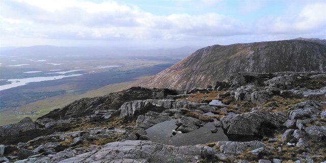 Photo could not load
L9549 : Corcogemore Summit
colm
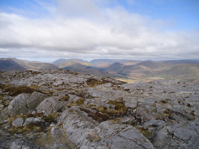 Photo could not load
L9549 : The summit of Corcogemore
Michael Earnshaw
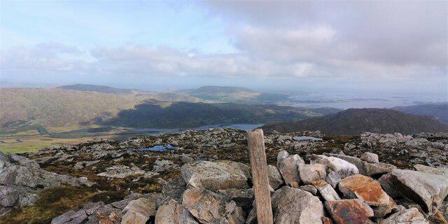 Photo could not load
L9549 : Corcogemore Summit, looking at Lough Corrib
colm
Hill facts and local notes
Classifications
Elevation
610m
2,002 ft
Prominence
226m
Coordinates
53.4821, -9.5784
L952491
OS Map
45
At the Summit
The summit features a classic grassy plateau with panoramic views; there's a well-structured cairn marking the peak.
Terrain & Geology
Primarily composed of Silurian sedimentary rocks, Corcogemore presents a fascinating blend of geology primarily shaped by glacial activity, resulting in a stunningly rugged landscape.
Views & Scenery
From the summit, you can enjoy views of the majestic Sperrin Mountains and the wide expanse of Lough Neagh in the distance.
History & Heritage
Name Origin
The name 'Corcogemore' derives from the Irish 'Corcog', meaning 'the hill of the hollow', while 'more' indicates it is the larger of several hills in the area.
Historical Significance
Rich in folklore, this mountain is linked to numerous local legends, making it a culturally important landmark.
Getting There & Facilities
Parking
Parking is available at the end of Corrig Road, which comfortably accommodates several vehicles.
Public Transport
Bus services to the nearby village of Draperstown, after which a short taxi ride to the trailhead is advisable.
Nearby Facilities
Basic facilities are available in Draperstown, including cafes and toilets. The local pub serves a mean post-hike pint!
Safety Information
Known Hazards
- Potential for slippery conditions in wet weather; low visibility can occur in misty conditions.
General Safety Tips
- Check weather conditions before setting out
- Carry appropriate clothing and equipment
- Let someone know your planned route
- Take a map, compass, and GPS device
- Carry emergency supplies: food, water, first aid kit, torch
Hills
Some common questions about the hills answered
Are there group walks up Corcog [Corcogemore]?
Many walkers use Walkmates to join or organise walks with others. You can check for group walks around Corcog [Corcogemore] through the maps
Are there other walkers around Corcog [Corcogemore]?
Activity varies by location and time, but Walkmates lets you see whether others have shared walks or shown interest in this area. Find other people through the walking friends search walking friends for Corcog [Corcogemore] search or of course create your own walk for Corcog [Corcogemore]
Can I organise a walk to Corcog [Corcogemore]?
Yes. If there aren’t any walks listed already, you can create a walk and make it available for others to join.
If you're signed up to Walkmates, you can create a walk to Corcog [Corcogemore].
How do I find a walk up this hill?
There are often multiple ways to walk this hill, depending on experience and route preference. Walkmates helps you explore walks and routes that others have shared.
Can I suggest a new route up Corcog [Corcogemore]?
Yes. You can suggest or create routes to share with others. Walkmates focuses on the social side of walking, so routes are used to help people organise walks and explore areas together, rather than as detailed navigation tools or route libraries.
Other uses really appreciate knowledgeable walkers sharing their routes. Share your favourite route to Corcog [Corcogemore] here
The is an error or something incorrect about this hill. How do I let you know?
We always strive to keep the information on Walkmates as accurate as possible. If you find an error, please let us know through the contact form and we'll aim to correct it as quickly as possible
Community Discussion
Comments
Location
![Corcog [Corcogemore] location map](https://cdn.walkmates.com/hill-maps/hill-sources/20213/53.48205_-9.57842.png)
Grid reference: L952491
View on OpenStreetMapOpens a map in a new tab, centred on the hill.
No comments yet. Be the first.